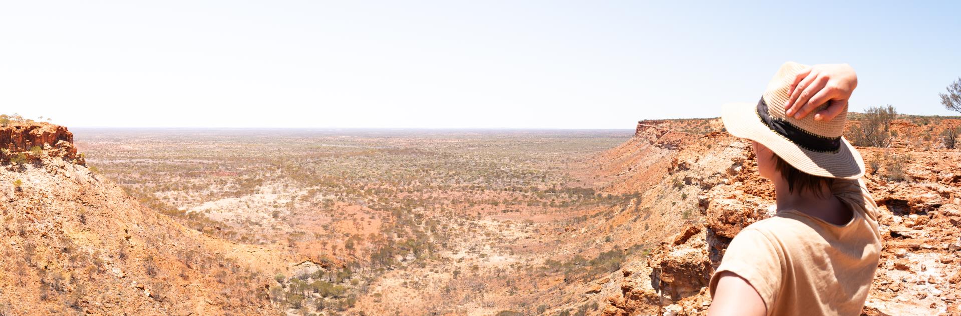
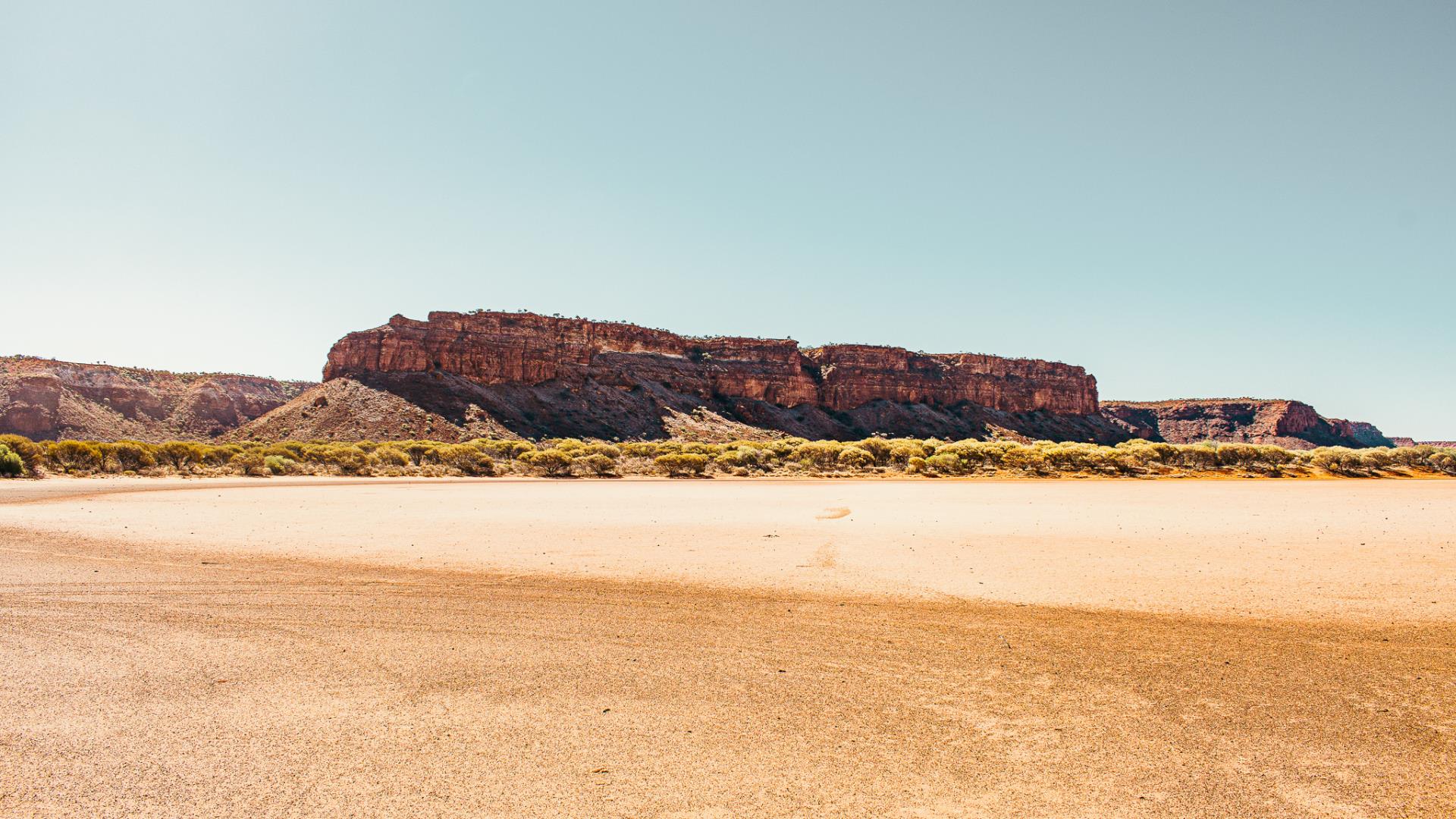
Kennedy Range National Park
Situated 230km inland from Carnarvon the Kennedy Range National Park stretches out over 75km in length and are a result of millions of years of erosion where the natural force of winds, rains and movement of the earth’s crust have combined to etch out valleys and create remarkable cliff faces.
There are several walk trails which take visitors through scenic sections of the national park. Visitors in August and September will be treated to a range of beautiful wildflowers. The national park allows camping in designated camping areas.

ACCESS
Fuel supplies are at Gascoyne Junction and the Mount Augustus Tourist Park. Gascoyne Junction to Mt Augustus is 305km (via the Ullawarra Rd) and 288km (via the Carnarvon-Mullewa/Cobra Dairy Creek Rd). Roads in the inland Gascoyne are mostly unsealed. Roads can be substantially damaged and/or closed after rainfall. Call in to the Carnarvon Visitor Centre for the latest road condition report. Note, closures of the road can occur whilst you're travelling.
4WD ADVENTURE
Access to the western side of the park via the Gascoyne River is recommended only to those with a high-clearance/capacity four-wheel-drive vehicle. There are no marked walk trails and the track is rough. The Gascoyne River crossing is about 200m of soft sand. Make sure you are well informed and well equipped before considering this track. There is one information shelter located on the southern side of the Gascoyne River and one located about 35km north of the Gascoyne River (on the track entering from the west).

WALK TRAILS
There are several trails in the park that give you the opportunity to explore the park’s range country and its plants and animals. Most of the walk trails follow creek lines and are often rocky. Rock pools are seasonal and not fit to drink from. Visitors should read the information on signage for each trail, taking particular note of the difficulty rating. These walk trails have been graded according to the Australian Standards for Walking Tracks. Look for the different coloured markers indicating the trail class.
The following two classes apply to the walks in Kennedy Range:
CLASS 3 – Users require a moderate level of fitness. Trails may be slightly modified and include unstable surfaces.
CLASS 4 – Trails are in relatively undisturbed environments and are often rough with few if any modifications. A moderate to high level of fitness is required. Users should be prepared and self reliant.
Temple Gorge Trail – The trail starts at the day-use site and it takes about two hours to complete. Follow the trail until you reach a fork in the creek under a prominent rock face: it’s called the Temple. This walk is a CLASS 3 & 4.
Honeycomb Gorge – If you’re after a fairly easy walk, this is the one for you. It’s approximately 600m return taking up to 40 minutes to accomplish. The rocky trail takes walkers to a large natural amphitheatre containing a cooling seasonal waterfall and pool. This walk is a CLASS 3.
Sunrise View Trail – As the name suggests, this is one for early risers. The short walk is approximately 300m return taking up to 15 minutes to finish. The best time to visit the range is August and September, when the wildflowers are in full bloom. This walk is a CLASS 3.
There are six walk trials – Temple Gorge, Honeycomb Gorge, Drapers Gorge, the Escarpment Trail (leading to the top of the range), the Escarpment Base Trail, and Sunrise View.

CAMPING AT KENNEDY RANGE
Temple Gorge campground is a bush campsite. Camping fees are $8 for Adult (16 Years or older), $6 for Concession and $3 for Children (6 - 15 Years). Booking are not required for this camp site, simply arrive and find a spot. Drop toilets are provided but there is no water available. Camp hosts are available from May to September, outside of this period an honesty box is available to pay your camping fees. There is a communal fireplace at the Temple Gorge campground. To protect wildlife habitat and the ecology of the National Park, please collect firewood before arriving to the park. Collecting wood in the National Park is not permitted, you can purchase firewood from Home Hardware in Carnarvon prior to setting off on your adventure. Personal campfires are strongly discouraged and NO fires are permitted during a fire band period (during summer and windy conditions).
TIPS FOR YOUR SAFETY
The risks from exposure and dehydration are significant in this area. During the hotter months (at least December – March) these risks are extreme. Temperatures often exceed 40 degrees Celsius.
- Walk in groups of three or more – in an emergency one might need to wait with the injured person while someone goes for help;
- Tell a trusted and responsible person of your plans and provide sufficient detail to them so they can get help if required;
- Each person needs to carry and drink 3 to 4 litres of water per day of walking;
- Carefully review your daily drinking water needs. Carry cool water if possible;
- There is no drinking water in the park. Extra water may be needed if walking in the hotter months;
- Plan your walk for the most suitable season and/or daily weather conditions;
- Wear a broad brimmed hat, sunscreen and a loose long sleeved shirt for protection from the sun;
- Take regular breaks when walking;
- Wear sturdy footwear and follow the trail markers; and
- Walk during the cooler parts of the day – there will also be more wildlife about during this time.
Walk trails are usually natural unmodified surfaces. Beware of:
- Undercut cliff edges; and
- Loose rocks and unstable surfaces.
This is a remote destination, and you will be required to travel on unsealed roads. Weather events may impact road conditions.
Please check the road safety reports and ensure your vehicle is adequately equipped prior to commencing your journey.
We have provided the following links for your convenience.